
Do you find Resources and Development of class 10 difficult to memorise and retian for the upcoming examination?
Read “Resources and Development short notes” for easy to meorize and quick to revise!
The below short notes is strictly created out of your class 10 ncert book Chapter 1- Resources and Development
Table of Contents
Resources: Definition, Classification & Challenges
What are Resources?
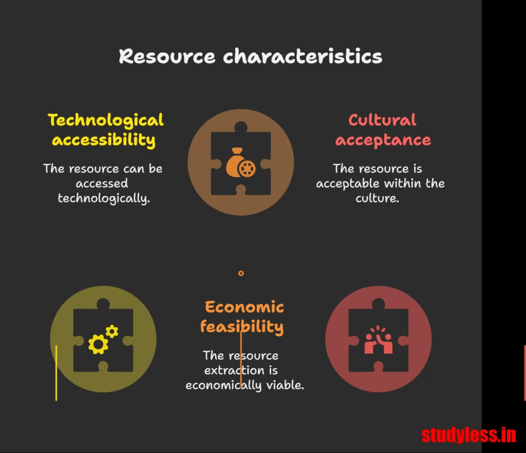
- Definition: Anything in our environment that can satisfy needs, provided it is:
- Technologically accessible
- Economically feasible
- Culturally acceptable
- Transformation Process of things : Involves an interactive relationship between nature, technology, and institutions.
- Human beings interact with nature through technology and create institutions to accelerate economic development.
- Are they free gifts of nature?No, they are a function of human activities.
- Human beings are essential components of resources as they transform materials into resources and use them.
Classification of Resources
Resources can be classified in various ways:
| Basis of Classification | Types of Resources |
|---|---|
| Origin | Biotic, Abiotic |
| Exhaustibility | Renewable, Non-renewable |
| Ownership | Individual, Community, National, International |
| Status of Development | Potential, Developed Stock, Reserves |

Problems from Indiscriminate Use of Resources
Initial belief that resources were free gifts led to indiscriminate use, causing major problems:
- Depletion of resources for satisfying the greed of a few individuals.
- Accumulation of resources in few hands, dividing society into “haves” and “have-nots” (rich and poor).
- Indiscriminate exploitation leading to global ecological crises such as:
- Global warming
- Ozone layer depletion
- Environmental pollution
- Land degradation

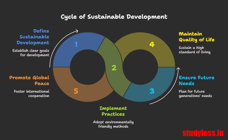
Sustainable Development
Concept of Sustainable Development
- Definition: Development should take place without damaging the environment, and development in the present should not compromise with the needs of future generations.
- Importance: Essential for a sustained quality of life and global peace.
- If current resource depletion trends continue, the future of our planet is in danger.
- Resource planning is essential for sustainable existence of all life forms.
Rio de Janeiro Earth Summit, 1992
- Date: June 1992
- Participants: More than 100 heads of states
- Purpose: Addressed urgent problems of environmental protection and socio-economic development at the global level.
- Outcomes:
- Signed the Declaration on Global Climatic Change and Biological Diversity.
- Endorsed the global Forest Principles.
- Adopted Agenda 21 for achieving Sustainable Development in the 21st century.
Agenda 21
- What it is: A declaration signed by world leaders in 1992 at the United Nations Conference on Environment and Development (UNCED) in Rio de Janeiro.
- Aim: Achieving global sustainable development.
- Objectives:
- Combat environmental damage
- Combat poverty
- Combat disease
- Through global co-operation on common interests, mutual needs, and shared responsibilities.
- Key Objective: Every local government should draw its own local Agenda 21.
Resource Planning & Conservation
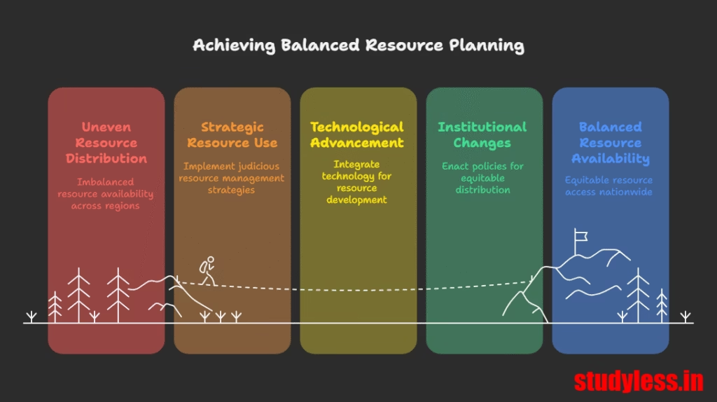
Importance of Resource Planning
- Strategy: Widely accepted strategy for judicious use of resources.
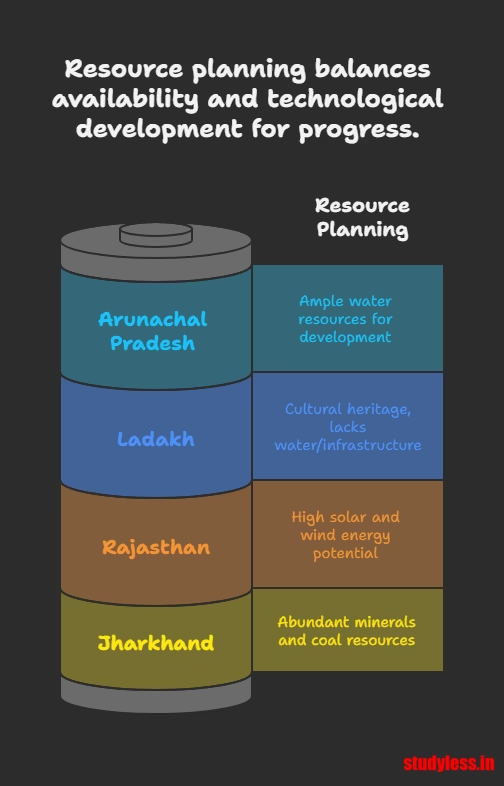
- Relevance to India: Crucial for a country like India due to its enormous diversity in resource availability.
- Some regions are resource-rich but deficient in others.
- Some are self-sufficient, others have acute shortages (e.g., Jharkhand rich in minerals/coal, Arunachal Pradesh in water, Rajasthan in solar/wind, Ladakh in cultural heritage but deficient in water/infrastructure/minerals).
- Calls for balanced resource planning at national, state, regional, and local levels.
- Development Link: Resources contribute to development only when accompanied by appropriate technological development and institutional changes.
- Availability alone is not sufficient.
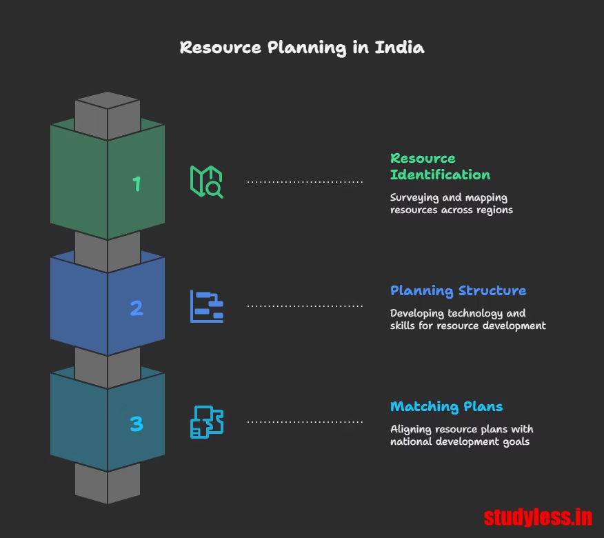
Resource Planning Process in India
A complex process involving three main steps:
Resource Planning Process
- Identification & Inventory of Resources across regions:
- Surveying
- Mapping
- Qualitative and quantitative estimation & measurement
- Evolving a Planning Structure:
- Endowed with appropriate technology
- Skill
- Institutional set up for implementing resource development plans
- Matching Resource Development Plans with Overall National Development Plans
- India has made concerted efforts since the First Five Year Plan after Independence.
Conservation of Resources
- Necessity: Resources are vital for developmental activity.
- Irrational consumption and over-utilisation lead to socio-economic and environmental problems.
- Conservation at various levels is important to overcome these problems.
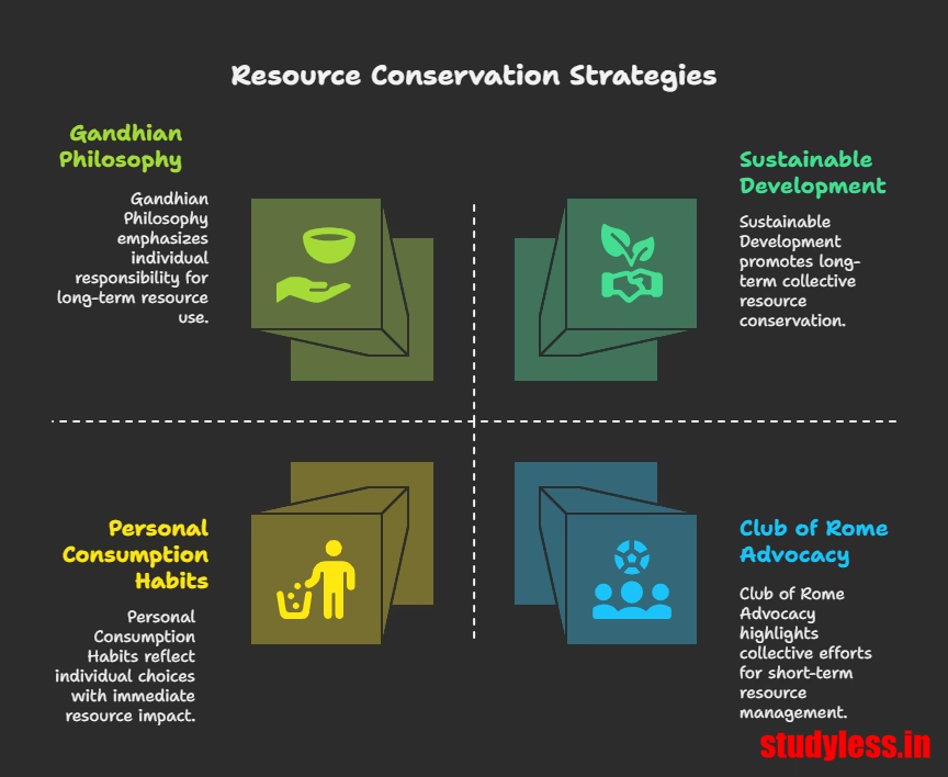
- Historical Concern: A main concern of past leaders and thinkers.
- Gandhiji’s Philosophy: “There is enough for everybody’s need and not for any body’s greed”.
- Blamed greedy individuals and exploitative modern technology for global resource depletion.
- Against mass production, favored production by the masses.
- Gandhiji’s Philosophy: “There is enough for everybody’s need and not for any body’s greed”.
- International Efforts for Conservation:
- 1968: Club of Rome advocated resource conservation systematically.
- 1974: Gandhian philosophy presented by Schumacher in “Small is Beautiful”.
- 1987: Brundtland Commission Report (published as “Our Common Future”) introduced Sustainable Development as a means for resource conservation.
- 1992: Earth Summit at Rio de Janeiro.
Land Resources
Importance & Relief Features of Land
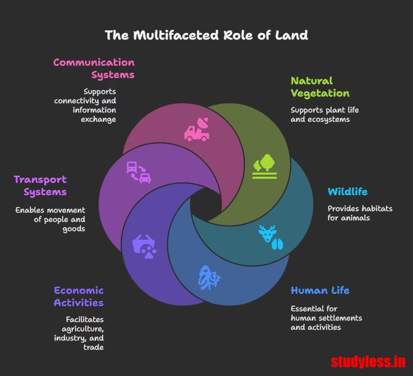
- Importance:Natural resource of utmost importance; we live on it, perform economic activities, and use it in various ways.
- Supports natural vegetation, wildlife, human life, economic activities, transport, and communication systems.
- Finite magnitude – proper use is critical.
- India’s Land under Relief Features:
- Total geographical area: 3.28 million sq km.
- Data available for 93% (due to un-surveyed areas like NE states, J&K occupied by Pakistan/China).
| Relief Feature | Percentage of Land Area | Benefits |
|---|---|---|
| Plains | 43% | Facilities for agriculture and industry |
| Mountains | 30% | Perennial river flow, tourism, ecological aspects |
| Plateaus | 27% | Rich reserves of minerals, fossil fuels, forests |
Land Utilisation Categories
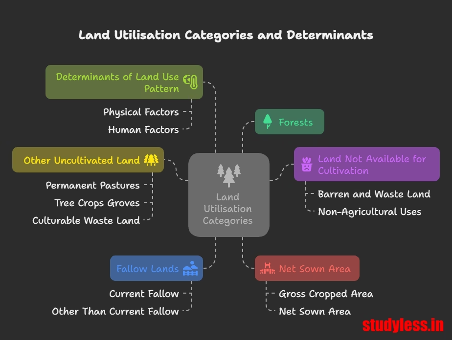
Land resources are used for the following purposes:
- Forests
- Land not available for cultivation:
- Barren and waste land
- Land put to non-agricultural uses (e.g., buildings, roads, factories)
- Other uncultivated land (excluding fallow land):
- Permanent pastures and grazing land
- Land under miscellaneous tree crops groves (not included in net sown area)
- Culturable waste land (uncultivated > 5 agricultural years)
- Fallow lands:
- Current fallow (uncultivated for 1 or less than 1 agricultural year)
- Other than current fallow (uncultivated for 1 to 5 agricultural years)
- Net sown area: Physical extent of land on which crops are sown and harvested.
- Gross cropped area: Area sown more than once in an agricultural year + net sown area.
- Determinants of Land Use Pattern:
- Physical Factors: Topography, climate, soil types.
- Human Factors: Population density, technological capability, culture and traditions.
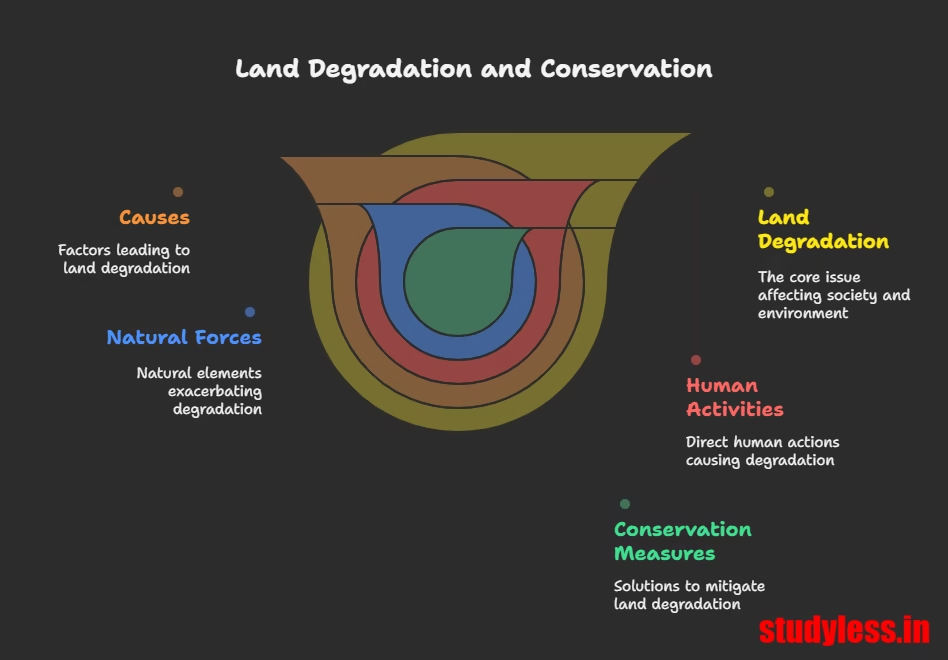
Land Degradation and Conservation Measures
- Land Degradation: Continuous use of land over a long period without appropriate conservation/management measures.
- Causes:
- Human activities:
- Deforestation
- Overgrazing (e.g., Gujarat, Rajasthan, MP, Maharashtra)
- Mining and Quarrying (abandoned sites, deep scars, overburdening, deforestation in Jharkhand, Chhattisgarh, MP, Odisha)
- Over-irrigation (e.g., Punjab, Haryana, W. Uttar Pradesh) leading to water logging, salinity, and alkalinity
- Mineral processing (grinding limestone, calcite, soapstone) generates dust, retarding water infiltration
- Industrial effluents and waste (major source of land and water pollution)
- Natural forces: Aggravated pace of natural forces to cause damage.
- Human activities:
- Consequences: Serious repercussions on society and the environment.
- Causes:
- Conservation Measures (Ways to solve land degradation):
- Afforestation
- Proper management of grazing
- Planting of shelter belts of plants
- Stabilisation of sand dunes by growing thorny bushes (in arid areas)
- Proper management of waste lands
- Control of mining activities
- Proper discharge and disposal of industrial effluents and wastes after treatment (in industrial/suburban areas)
Soil as a Resource
Importance & Formation of Soil
- Importance:Most important renewable natural resource.
- Medium of plant growth.
- Supports different types of living organisms on Earth.
- A living system.
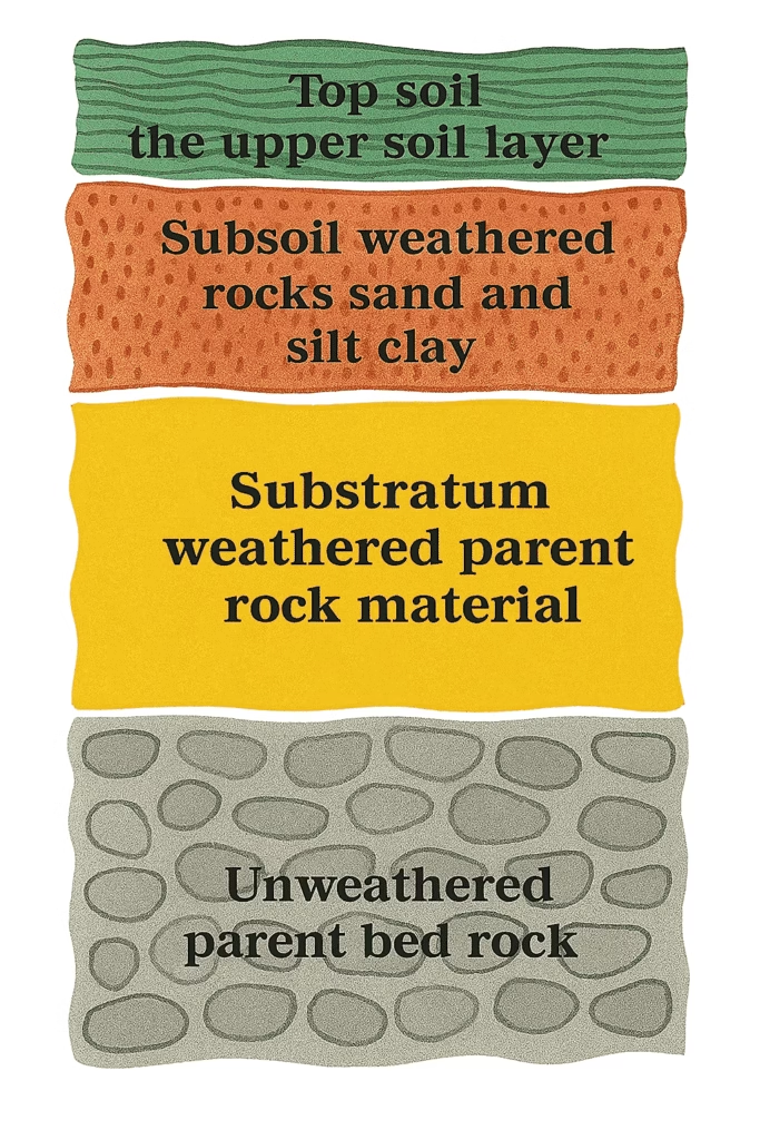
- Formation: Takes millions of years to form soil up to a few cm in depth.
- Important Factors: Relief, parent rock/bedrock, climate, vegetation, other forms of life, and time.
- Forces of Nature: Change in temperature, actions of running water, wind, glaciers, activities of decomposers.
- Internal Processes: Chemical and organic changes.
- Composition: Consists of organic (humus) and inorganic materials.
- Soil Profile Diagram
Classification of Soils in India
Soils in India are classified based on formation factors, colour, thickness, texture, age, and chemical/physical properties. India’s varied relief, landforms, climate, and vegetation contribute to diverse soil types.
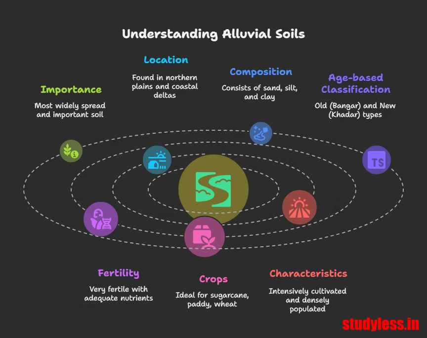
Alluvial Soils
- Importance: Most widely spread and important soil.
- Location:
- Entire northern plains (deposited by Indus, Ganga, Brahmaputra river systems).
- Extends in Rajasthan and Gujarat via a narrow corridor.
- Found in eastern coastal plains, especially deltas of Mahanadi, Godavari, Krishna, Kaveri rivers.
- Composition & Age-based Classification:
- Consists of various proportions of sand, silt, and clay.
- Coarser in upper reaches of river valleys (piedmont plains like Duars, Chos, Terai).
- Old Alluvial (Bangar): Higher concentration of kanker nodules, coarser, less fertile.
- New Alluvial (Khadar): Finer particles, more fertile.
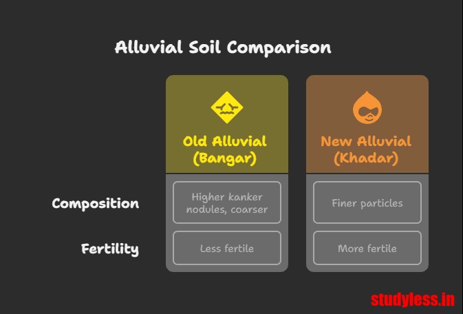
- Fertility:Very fertile.
- Adequate potash, phosphoric acid, and lime.
- Crops: Ideal for sugarcane, paddy, wheat, other cereal and pulse crops.
- Characteristics: Intensively cultivated and densely populated regions due to high fertility. Drier areas can be productive after proper treatment and irrigation.
Black Soil (Regur Soil / Black Cotton Soil)
- Colour: Black.
- Crop Association: Ideal for growing cotton, hence called black cotton soil.
- Formation: Climatic conditions along with parent rock material (typical of Deccan trap/Basalt region, made up of lava flows).
- Location: Covers plateaus of Maharashtra, Saurashtra, Malwa, Madhya Pradesh, and Chhattisgarh, extending along Godavari and Krishna valleys.
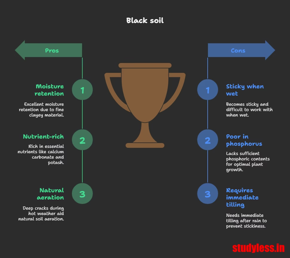
- Properties:
- Made up of extremely fine (clayey) material.
- Well-known for capacity to hold moisture.
- Rich in nutrients: Calcium carbonate, magnesium, potash, and lime. Poor in phosphoric contents.
- Develops deep cracks during hot weather (helps aeration).
- Sticky when wet and difficult to work on unless tilled immediately after first shower or pre-monsoon.

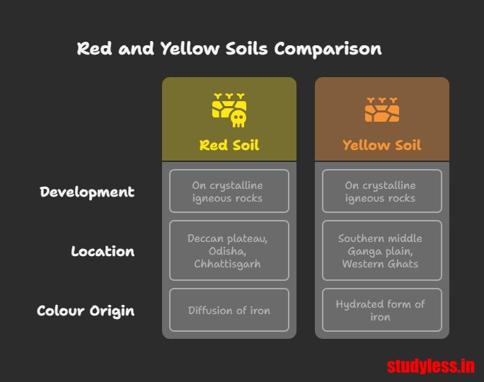
Red and Yellow Soils
- Development: On crystalline igneous rocks in low rainfall areas.
- Location: Eastern and southern parts of the Deccan plateau, parts of Odisha, Chhattisgarh, southern middle Ganga plain, and piedmont zone of Western Ghats.
- Colour Origin:
- Reddish colour: Due to diffusion of iron in crystalline and metamorphic rocks.
- Yellow: When it occurs in a hydrated form.
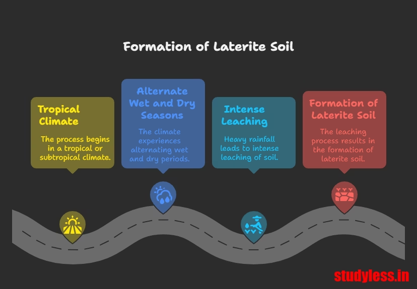
Laterite Soil
- Etymology: Derived from Latin ‘later’ (brick).
- Development: Under tropical and subtropical climate with alternate wet and dry seasons, result of intense leaching due to heavy rain.
- Location: Southern states, Western Ghats (Maharashtra), Odisha, parts of West Bengal, North-east regions.
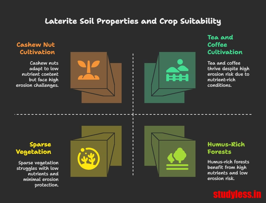
- Properties:
- Mostly deep to very deep.
- Acidic (pH<6.0).
- Generally deficient in plant nutrients.
- Humus-rich under deciduous/evergreen forests, humus-poor under sparse vegetation/semi-arid environment.
- Prone to erosion and degradation due to landscape position.
- Crops (with conservation): Very useful for growing tea and coffee in hilly areas (Karnataka, Kerala, Tamil Nadu). Red laterite soils in Tamil Nadu, Andhra Pradesh, and Kerala are suitable for cashew nut.
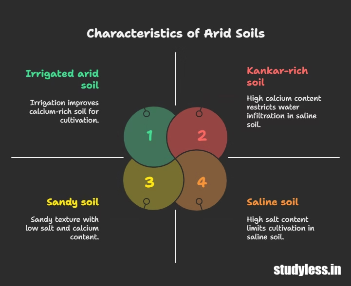
Arid Soils
- Colour: Red to brown.
- Texture & Nature: Generally sandy in texture and saline in nature.
- Properties:
- High salt content in some areas (common salt obtained by evaporating water).
- Lacks humus and moisture due to dry climate and high temperature.
- Lower horizons occupied by Kankar (increasing calcium content downwards), which restricts water infiltration.
- Cultivation: Can become cultivable after proper irrigation (e.g., western Rajasthan).
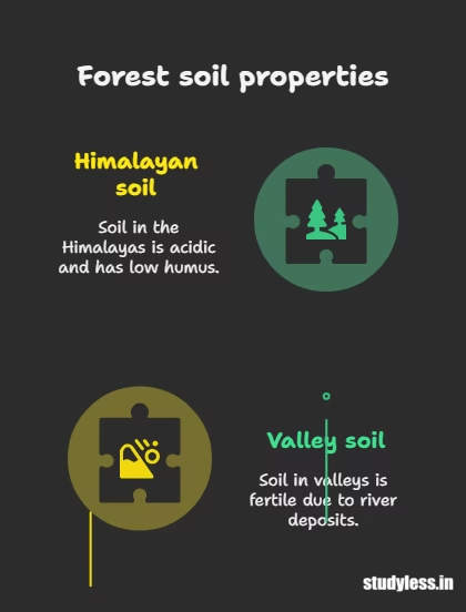
Forest Soils
- Location: Hilly and mountainous areas with sufficient rainforests.
- Texture: Varies with mountain environment:
- Loamy and silty in valley sides.
- Coarse grained in upper slopes.
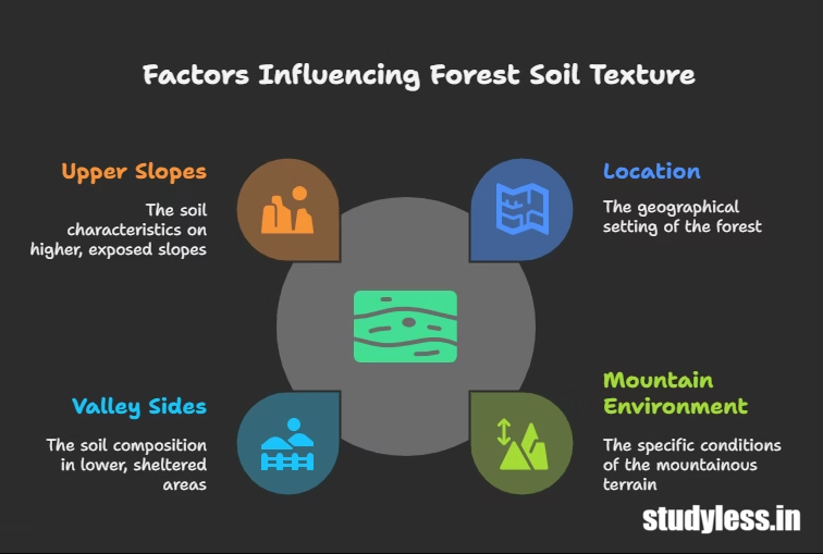
- Properties:
- In snow-covered Himalayas: Experience denudation, acidic, low humus content.
- In lower parts of valleys (river terraces, alluvial fans): Fertile.
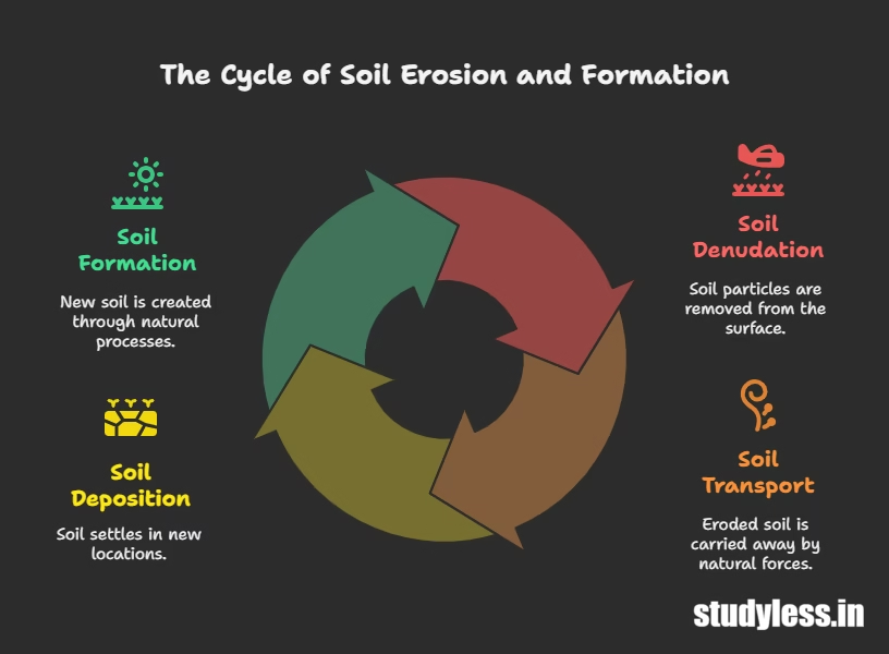
Soil Erosion and Soil Conservation
Soil Erosion
- Definition: The denudation of the soil cover and subsequent washing down.
- Balance: Soil formation and erosion typically occur simultaneously, maintaining a balance.
- Causes of Disturbance (Erosion):
- Human Activities: Deforestation, over-grazing, construction, mining.
- Natural Forces: Wind, glacier, water.
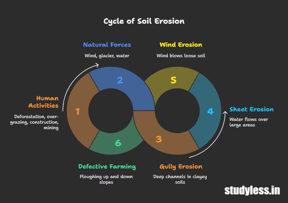
- Types of Water Erosion:
- Gully Erosion: Running water cuts through clayey soils, making deep channels called gullies. Land becomes unfit for cultivation (“bad land,” “ravines” in Chambal basin).
- Sheet Erosion: Water flows as a sheet over large areas down a slope, washing away the topsoil.
- Wind Erosion: Wind blows loose soil off flat or sloping land.
- Defective Methods of Farming: Ploughing up and down the slope forms channels for quick water flow, leading to erosion.
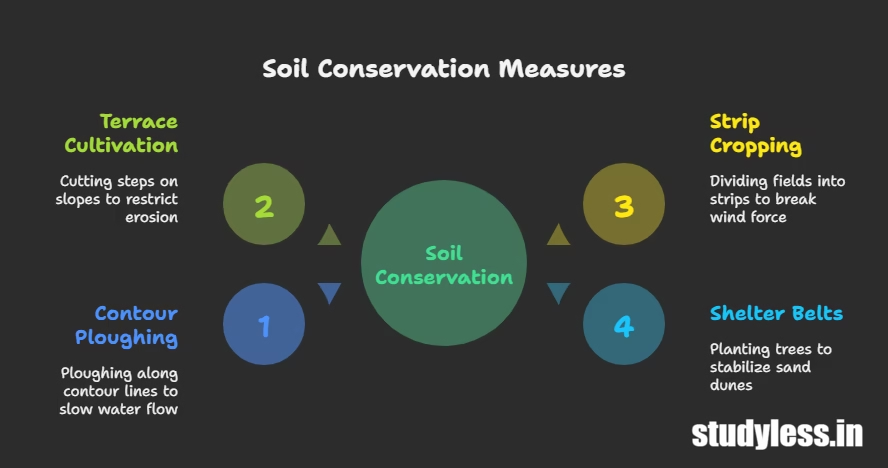
Soil Conservation Measures
- Contour Ploughing: Ploughing along contour lines to decelerate water flow down slopes.
- Terrace Cultivation: Cutting steps on slopes to restrict erosion (well-developed in Western and Central Himalayas).
- Strip Cropping: Dividing large fields into strips, with strips of grass left between crops to break the force of the wind.
- Shelter Belts: Planting lines of trees to create shelter, which helps stabilize sand dunes and the desert in western India.
You may also like The Rise Of Nationalism In Europe


Leave a Comment